GIS Mapping
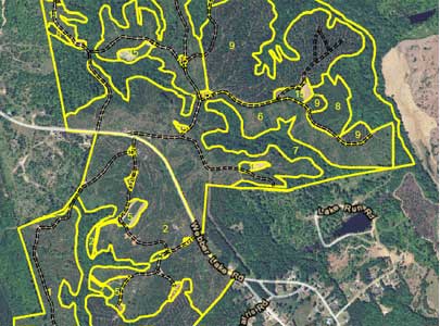
Southeastern Forestry uses the most advanced technology available to undergo GIS mapping of our clients’ properties. Having access to GIS maps allows us to more effectively develop long term land management plans for clients by giving us a great “bird’s eye view” of the property. GIS maps show the features of the land such as -
- Distribution of timber by type and age
- Wildlife habitat
- Features of neighboring properties
- Bio-diversity
- Land types
- Topography
- Access to harvest areas
- and more